 As a final project, I worked with two other team members in creating a study looking into the feasibility of operating a rail transit line down the decommissioned Canadian Pacific Railway (CPR) tracks along the Arbutus corridor in Vancouver. Our overall goal was to prepare a report with accompanying maps and visuals showing a proposed route and station locations for an Arbutus line, along with surrounding areas and points of interest in the vicinity. These would be for presentation to the municipal government and TransLink for their further consideration.
With a project featuring multiple elements, from initial data acquisition to ArcMap shapefile manipulation to flowchart creation, it was essential our work be split up into manageable portions and delegated to individual members, ideally suiting their particular strengths and interests. Team organization and structure was critical to ensuring that we stayed on course and on schedule, as well to as to prevent our data and files from becoming disjointed from one another. I focused on the technical mapping and editing processes, as well as the report writing afterwards, working in tandem with my partners who were both providing input and feedback for the analytical steps, and following along creating the flowchart as we continued on.
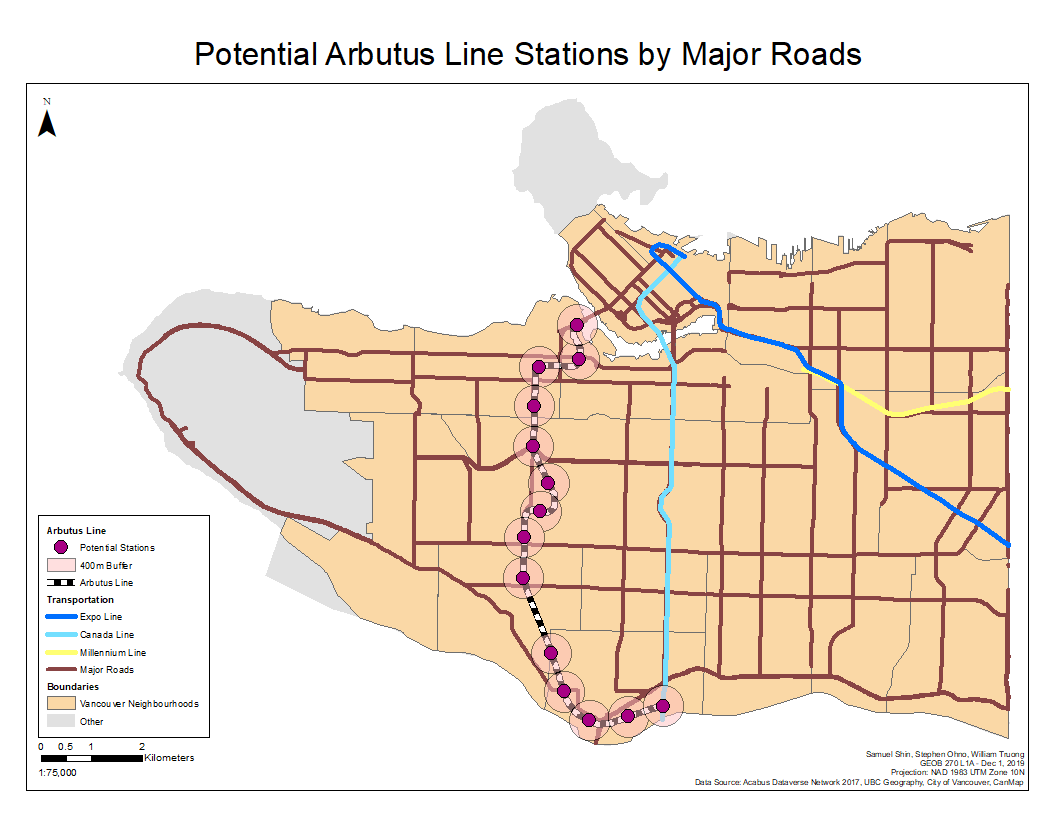
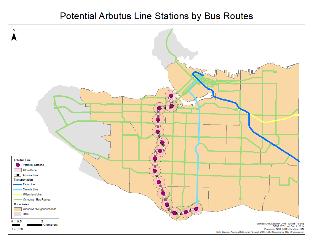
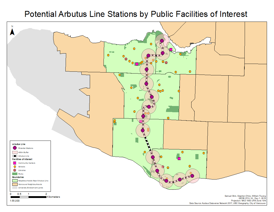
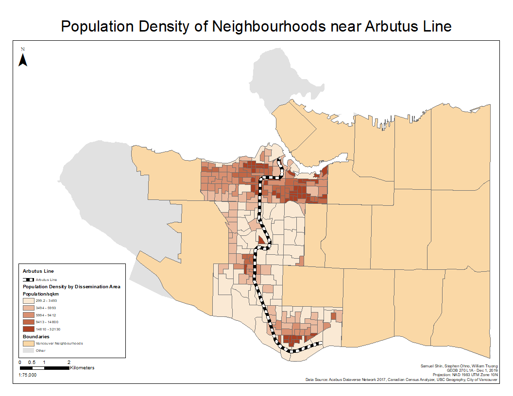
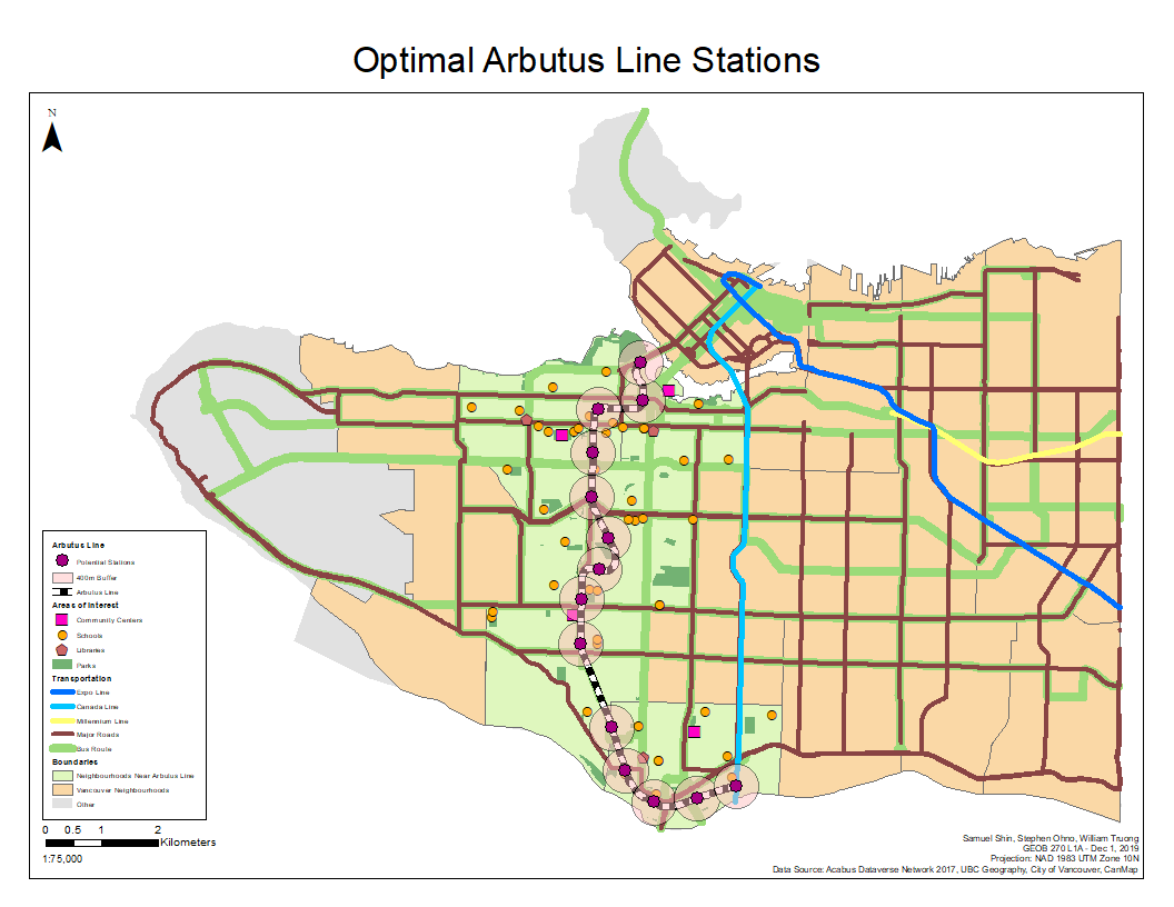
As we worked through the project, one of the interesting things that caught our attention was the distribution of population density along the Arbutus corridor, with it being concentrated near the north end around Broadway and Granville Island, and also at the south end towards Marpole and Marine Drive. The density in between these areas is quite low, and the building makeup consists largely of single-family detached homes. However, by combining population density with maps of other kinds of transport connections, we concluded that there was great potential for transit-oriented development along an Arbutus line, and would also serve to improve access to the overall transit network for those living to the east of the existing Canada Line Skytrain.
One of the more persistent issue we ran into fairly early was the availability of public accessible, up-to-date data to use in ArcGIS for some parts of our analysis. An example would be the shapefiles of the networks of roads and bus routes in Vancouver, which for us dated back to 2010. To ensure our analysis would not be severely compromised by this older data, we manually compared the location and route information we would use against recently-updated maps (which were not in formats we could use) to check if there were radical differences that could affect our results. We ultimately determined that there were few changes between the versions, if any at all, and any differences that were present would not be significant enough to affect our overall findings.
Final Report - Final Project Report
Flow Chart - Appendix III - Flow Chart
Learning Significance