The proposed project is named Garibaldi at Squamish, which is a proposed year-round destination mountain resort to be located 15km north of Squamish on Highway 99. The BC Environmental Assessment Office released a report indicating the project was lacking information on potential effects on vegetation, fish and wildlife habitat, and recommended measures to reduce the impact of any of these effects. The Municipality of Whistler also raised concerns over climatological considerations that could rule out skiing on the lower 555m of the vertical surface, calling into question the viability of the project’s height to support skiing.
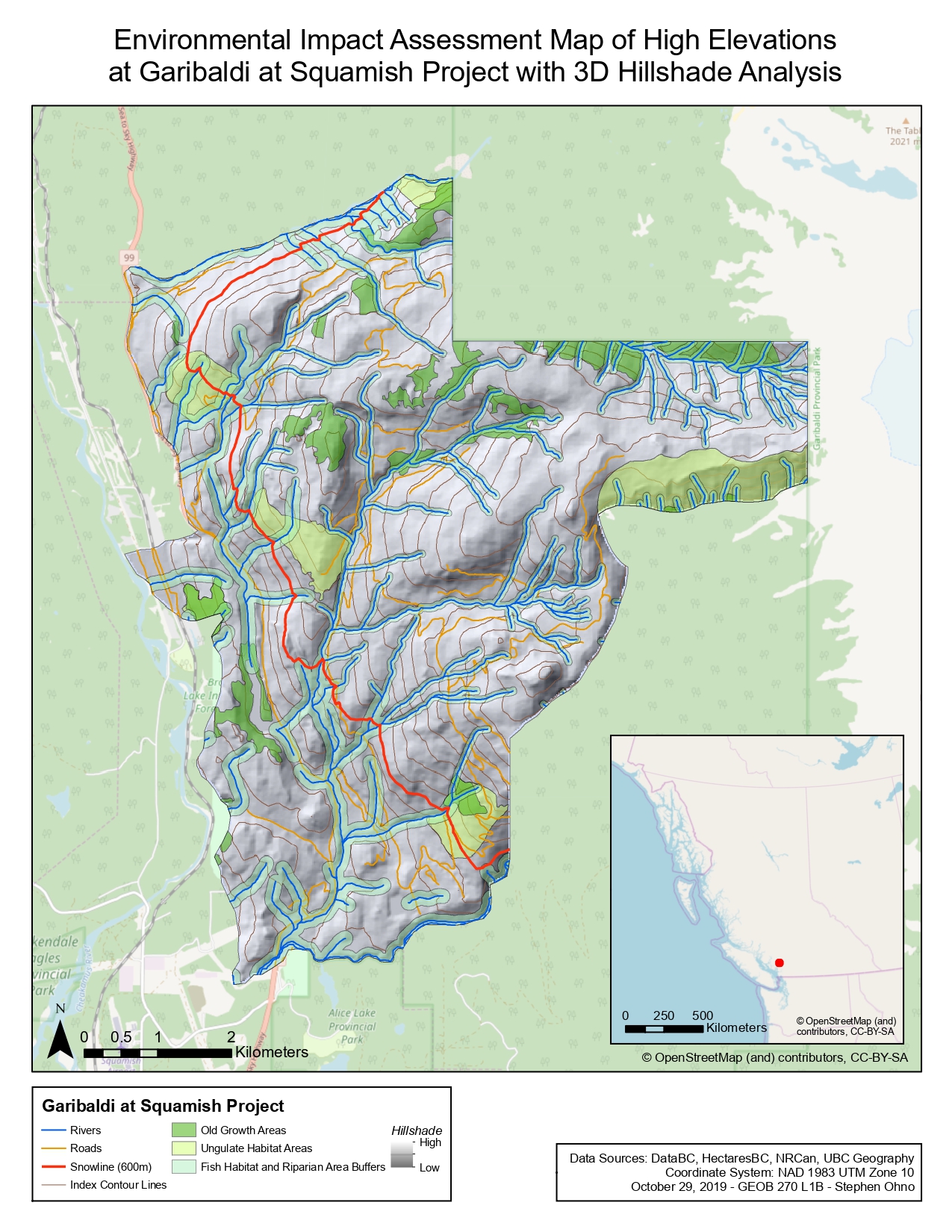
The maps created for this analysis took into consideration the elevation of the project area, as well as areas of old growth forests, the habitat areas of ungulates, and areas of fish bearing streams and fish habitats near to rivers. In order to create the base working maps, a general map of the Sea to Sky region was clipped to include only the project boundary areas. Using data from DataBC and other sources, files containing regional road, river, terrain contour, old growth area, and ungulate habitat areas were also clipped to the boundaries of the project.
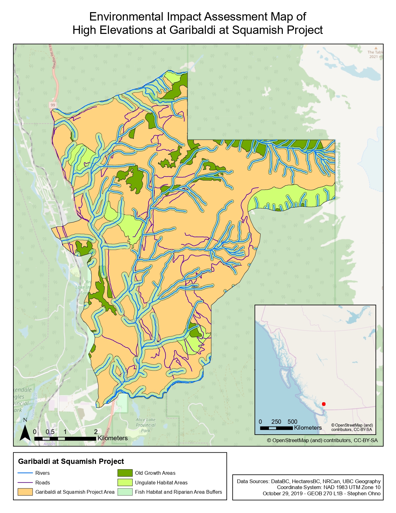
The areas of protected areas like the ungulate habitats and old growth areas were calculated and compared to the total project area to determine their total share of the overall project area. Areas around rivers were given a variable width buffer region; rivers below an elevation of 600m were given a buffer of 100m on either side, while rivers above the snowline elevation at 600m were considered to have a lower likelihood of containing fish habitats and were given a buffer of 50m. These buffered areas and earlier calculated protected areas were combined in a union (to prevent double counting and overlapping) to determine the total share of the overall protected area within the project area boundaries.
The total area of the project area is 54.72 square kilometers, while the area of the total protected spaces was determined to be 21.09 square kilometers. This works out to represent 38.54% of the total project area.
Care must be taken when carrying out many of the steps of this analysis, such as when adding surface information to our raster surface, which is needed to create the variable width buffer. For example, when setting a merge rule for our line segments, using a Mean rule would result in a weighted average being used for adjoining segments rather than their actual values. This could introduce error into our data.
Due to the widespread nature of the protected areas throughout the project boundaries, this may pose significant trouble for any construction and development which will need to avoid intruding into these zones. This may cause further problems in the future should critical skiing or resort infrastructure need to be built in these areas, and would complicate the overall viability of the project as a whole.
Learning Significance