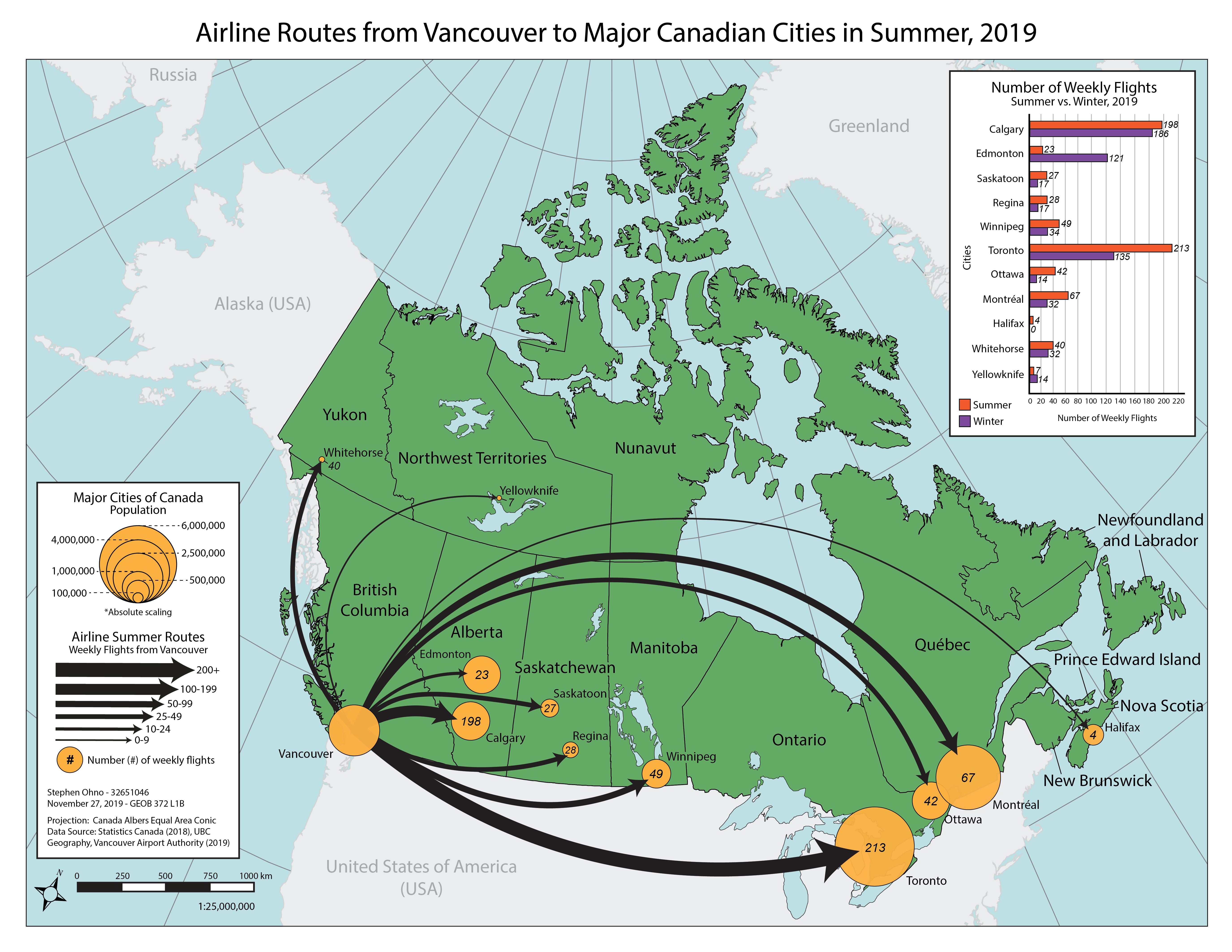
The overall goal of this map was to visually show the extent of various airline routes from Vancouver to major Canadian cities that were operating in the Summer of 2019. The destination cities were sized proportionally according to their populations using a sizing formula in Microsoft Excel, and symbolized using proportional circle symbols. Additionally, each airline route was also weighted by size to represent the volume of weekly flights departing from Vancouver. The exact number of flights per week to each city was indicated numerically inside (or near) each destination city.
Provinces and territories and neighbouring countries were all labelled for clarity and ease of reference.
Additionally, a graph in the upper right compares the number of weekly flights to each city in Winter, 2019 versus Summer, 2019. This allows readers to quickly see which cities are served more frequently depending on the season, as well as easily determine which cities are the most and least served overall as well.
The base map of Canada was sourced from the UBC Geography Department, while city population data was acquired from population statistics released as part of a Statistics Canada 2018 population estimate. Weekly flight numbers and destinations were sourced from the Vancouver Airport Authority.
Learning Significance