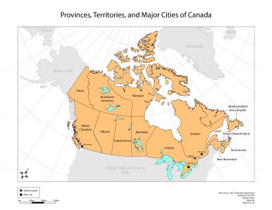
In this lab, the assignment was to create a map of Canada with labelled provinces and territories, the national capital, as well as major cities with populations over 2 million. Lakes were coloured in, and other nations added and labeled (faded for visual hierarchy).
Learning Significance