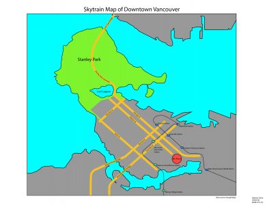
In this lab, the assignment was to trace the layout of the Downtown Vancouver area from a base map, as well as some surrounding shoreline in the Kitsilano, East Vancouver, and North Shore areas. Using Adobe Illustrator, the water and major park areas (Stanley Park) were added, as well as major streets, bridges, and a chosen landmark (BC Place). For this map, my chosen attribute was Skytrain layout, and therefore the lines for the Expo and Canada Lines were added, as well as stations within the map area.
Learning Significance