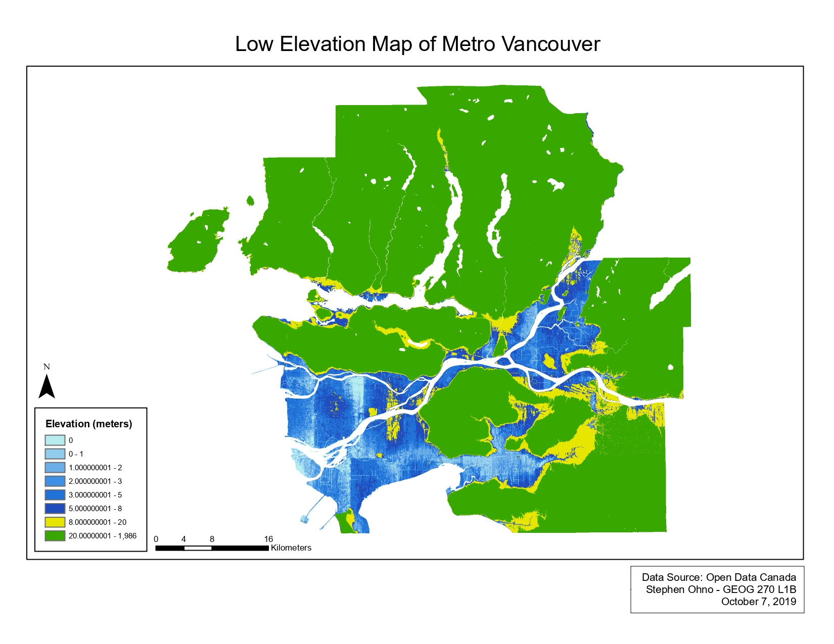
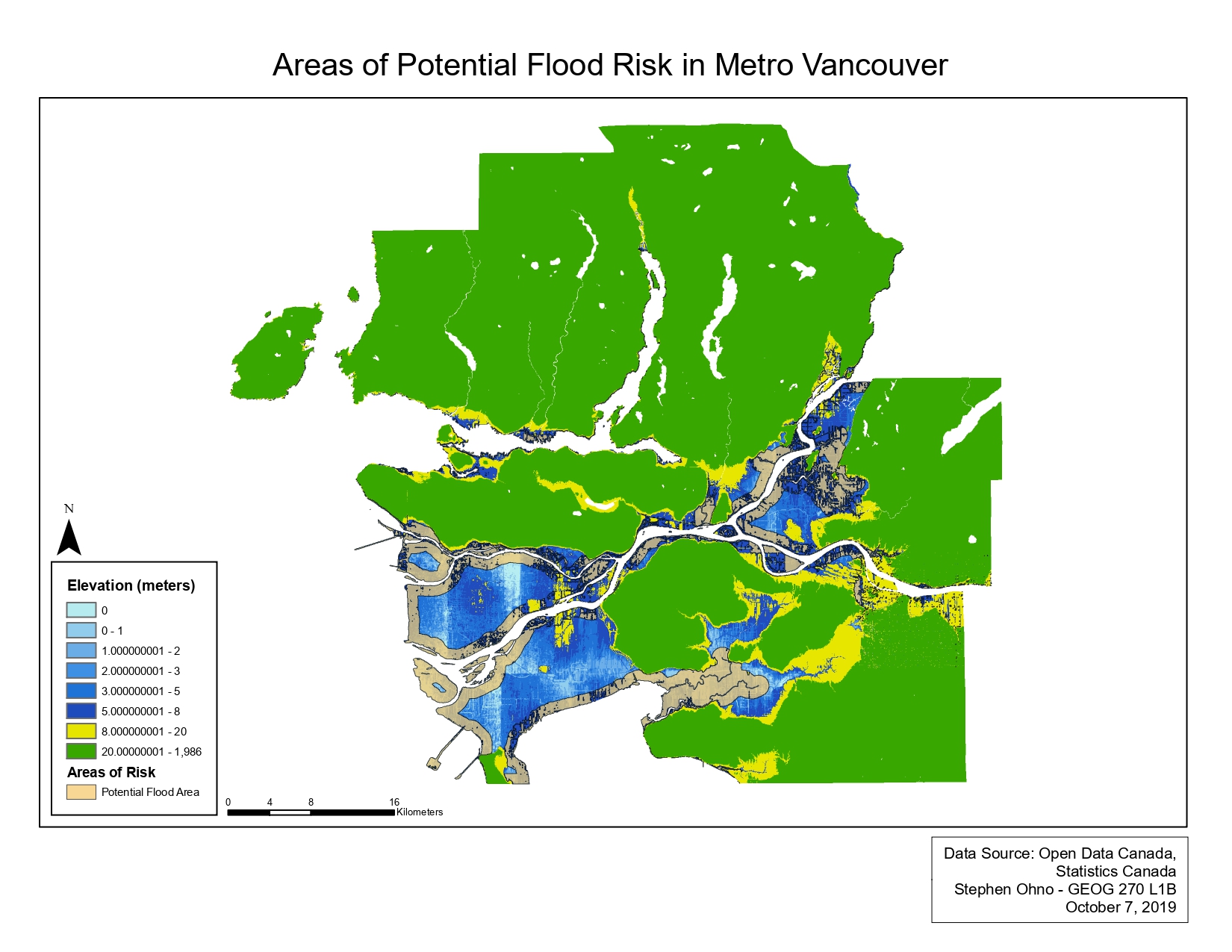
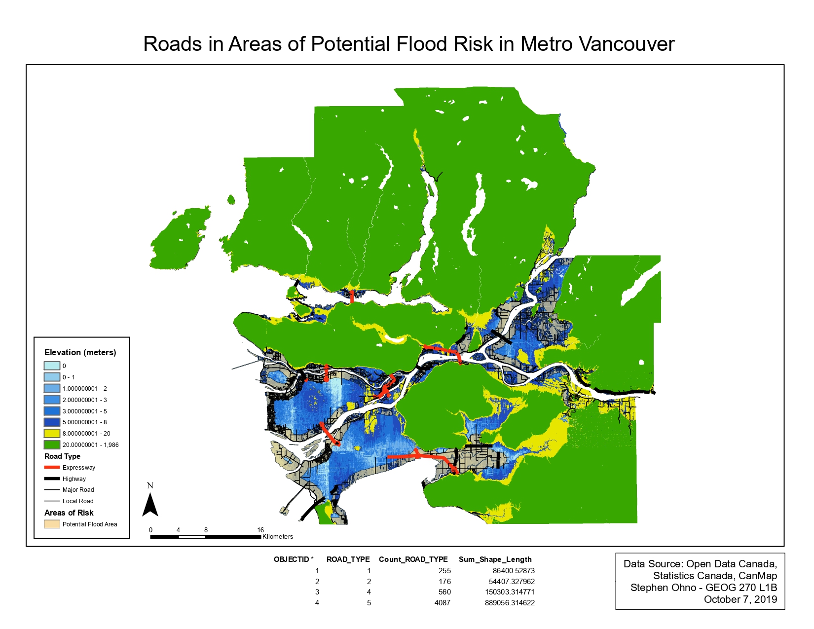
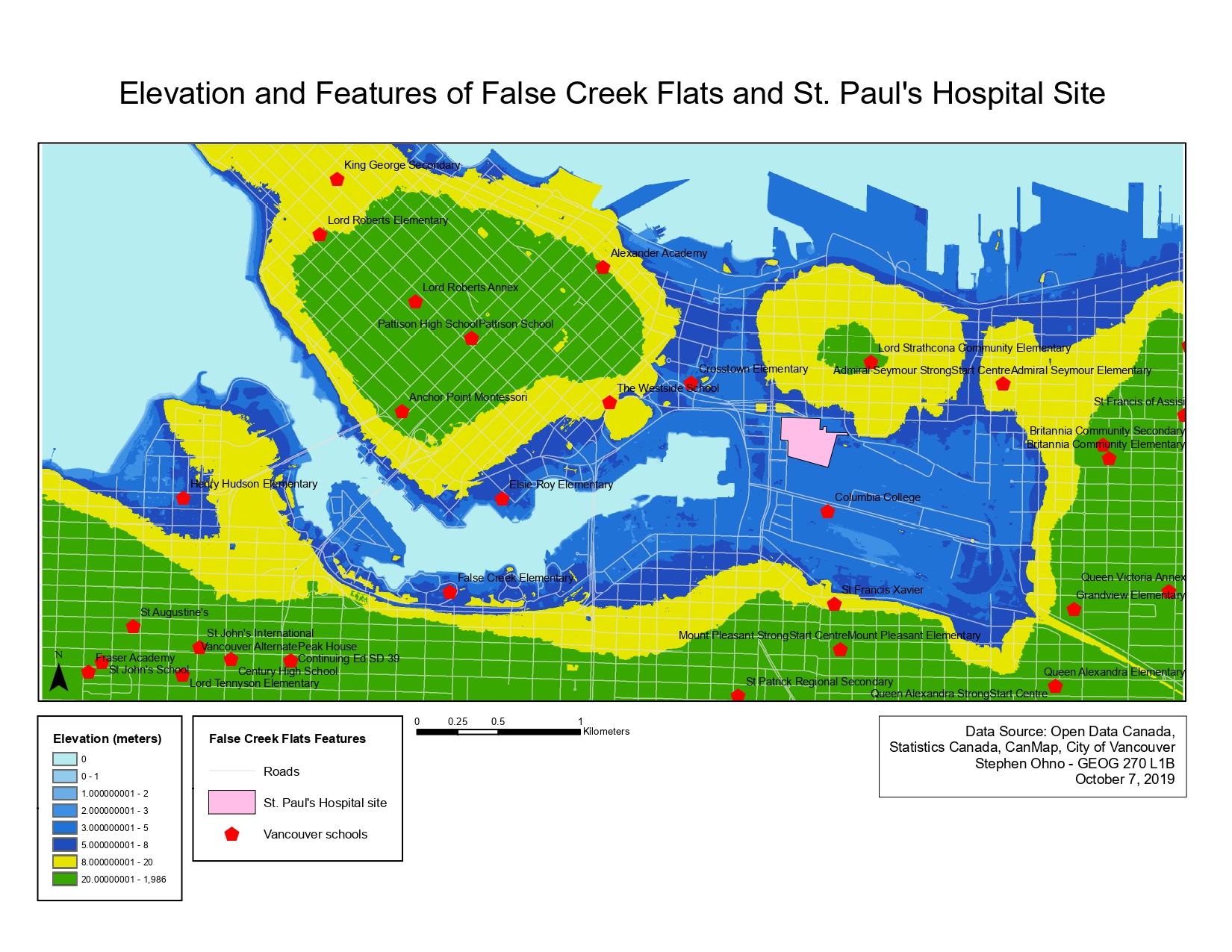
The created maps all include elevation information for Metro Vancouver, and the False Creek Flats area in particular. The maps display the elevation of the region in order to determine which areas could be at greater potential risk during storm surges and resulting flood situations, as well as areas within a 1 kilometer buffer of the shore. It also shows the types of roads that fall into these areas, and any schools within Vancouver city limits that could potentially be in these risk areas as well.
The resolution of the regional digital elevation model (DEM) is 25 meters, while the False Creek DEM is at 1 meter. For analysis of situations covering the region at this level, the resolution of the regional DEM would be sufficient to display relevant information. However, this same resolution would result in a loss of accuracy if we were to zoom in to False Creek, and could create the potential for error (i.e., a school could appear to fall into a risk area if the area is not accurately drawn) which is why the resolution of the False Creek DEM (1m) would be much more preferred at that point.
Learning Significance