In this lab, we were dealing with linkage of spatial data with attribute data, specifically in the City of Vancouver. The data provided was related to the native languages spoken by the population (either English, French, both, or neither). The data needed to be classified in the appropriate manner and then standardized in order to allow them to be compared against each other.
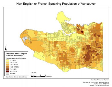
The final map of the lab showed the population of the city that had no native knowledge of either English or French. The data was classified according to the Natural Breaks method, and was displayed as a percentage of each of the city's dissemination area.
Learning Significance